Mangualde Municipality (Mangualde)
 |
 |
The region of Mangualde has been a crossroads of many peoples: Viriathus's warriors, transhumance shepherds, Romans, Moors and Christian conquerors, including soldiers from Castile or France, or even pilgrims. Mangualde was an important outpost in the textile trade from Covilhã, Seia and Gouveia. Its location, on the frontier with the Serra da Estrela and marginalized by its geography to north, was nonetheless a channel of pre-historic cultures associated with the dolmens that are found through the region. The mount of Nossa Senhora do Castelo, is one such example of the pre-Romanic castros that were used by the early settlers, then reappropriated by the Roman soldiers as forts.
The Romans, attracted by the riches of the Iberian Peninsula (primarily minerals), began to progressively occupy the region until the 5th century, when barbarians invaded the peninsula. Romanization of these lands resulted in a diffusion and assimilation of cultural structures, political hierarchies, social institutions, the economy and religious services. Mangualde was one of the principal access-ways in Lusitânia, connecting Emerita Augusta (Mérida) to Bracara Augusta (Braga). Along the roadway, millennium or road markers were discovered in Abrunhosa-a-Velha, noting the repairs completed to the road under emperors Hadrian and Numerian. Similarly, a second via crossed the Alcafache bridge (a Roman-built structure) towards Espinho, while another crossed the rivers from the north.
After the barbarian invasions, the region was also taken by Muslim forces, who occupied the area of Nossa Senhora do Castelo. This place became known by the military governor, Zurara, and the fort constructed on the site referred to asCastelo de Zurara (or also Castelo de Azurara), over time becoming transliterated in ancient name of the municipality: Azurara da Beira. In 1058, the medieval castle was conquered from the Moors, by the forces of Ferdinand I of León and Castile. By 1102, Count Henrique and Countess Theresa, before the independence of Portugal, issued a foral to the lands of Zurara, between the Dão and Mondego Rivers. It was later confirmed by Afonso II, when the monarch issued his ordinances in February 1217, and by King Manuel in 1514, during his reforms. When Christian forces finally took the fortress, they discovered a privileged lookout that provided line-of-sight for thousands of miles.
During the Middle Ages, the town of Mangualde grew from two distinct poles: the first was designated Cabo da Vila and the other Rossio.
With time, even the population of Rossio began to develop into another distinct neighborhood. Around this time (the middle of the 17th century) the new space was nothing more than some modest dwellings occupied by locals.
After the 17th century, with the creation of the Misericórdia by Philip II, the institution of "outside" judges by King John IV (1655), Mangualde experienced a period of great expansion.
In the 19th century, residential growth was significant, helped on by the construction of a new highway towards Guarda, which contributed to this development. Over time, the two original poles merged (in the 20th century), and Rossio took on a greater role: many of the social and economic functions of Mangualde concentrated in Rossio, including public services, banking, commercial shops and cafes.
On 3 July 1986, the Portuguese Assembly ratified the elevation of the town to the category of city.
Map - Mangualde Municipality (Mangualde)
Map
Country - Portugal
 |
 |
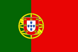
| Flag of Portugal | |
One of the oldest countries in Europe, its territory has been continuously settled, invaded and fought over since prehistoric times. The territory was first inhabited by pre-Roman and Celtic peoples who had contact with Phoenicians, ancient Greeks and Carthaginians. It was later ruled by the Romans, followed by the invasions of Germanic peoples and the Islamic invasion by the Moors, whose rule was eventually expelled during the Reconquista. Founded first as a county of the Kingdom of León in 868, gained its independence as the Kingdom of Portugal with the Treaty of Zamora in 1143.
Currency / Language
| ISO | Currency | Symbol | Significant figures |
|---|---|---|---|
| EUR | Euro | € | 2 |
| ISO | Language |
|---|---|
| PT | Portuguese language |


